Smack in the middle of the most beautifully rugged coastal section in the contiguous United States, Shelter Cove is a geographical anomaly in an otherwise inhospitable, inaccessible section of California coast. Situated on a broad marine terrace, it boasts enough flatland for an airport and sheltered ocean access where no similar facilities exist for this 100 mile section of otherwise lonesome coastline. A solid, almost vertical wall of mountains three quarters of a mile high rise straight out of the ocean on both sides of the Cove, and due to active geology and erosion, much of the coastal cliff faces are entirely devoid of vegetation. Road access is similarly difficult. The town could only be reached at the end of a long, sinuous drive on a narrow spur road nearly an hour from US101. A campground, general store, and a number of motels and restaurants dot the far end of the runway. The climate and vegetation are that of a temperate rain forest, with dense forest canopy and thick undergrowth, resulting in an extremely lush ambiance. For a fly-in visitor, it's hard to find a more attractive coastal getaway than this, especially if the weather is clear. The long distance Lost Coast Trail starts near town, giving access to inland hiking trails. The Mecca of California wilderness surfing, a primo surf break with no road access, is just a half-day's hike up the coast on the Lost Coast Trail. Offshore fishing is also big here.
National Geographic Adventure article on Lost Coast surfing
Aeroventure article on flying to Shelter Cove
North Coast Journal on the Shelter Cove Saga
The coastal terrace of Shelter Cove
For those who long for the Golden Age of aviation, Shelter Cove shall be considered a place of solace. A place not specifically built to be a fly-in community, it is a rare specimen of a town that physically centers on a strip of airport runway. Beautiful coast-side homes line the runway, yet most residents at Shelter Cove are not aviators and do not own an airplane, and for the number of properties in town there is but a small fraction of spaces for airplane parking on the tarmac.
The first time I came to Shelter Cove, I did it like almost everybody else. Coming from the San Francisco Bay Area via the US101, it was a seemingly endless, tortuous drive along the bends of the Russian River, followed by those of the Eel River. In contrast, the air traveler arrives here at Shelter Cove in style. There is no speed limit to watch for, no hairpin turn to negotiate, and no truck to pass on the way. Just a straight line along the coast, with a most visually spectacular one at that!
Black Sand Beach and the long distance Lost Coast Trail
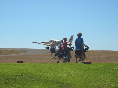
The Shelter Cove 9-Hole surrounds the runway
The Journey
Our largely impromptu flight route treats us to a terrific visual feast of a huge section of California coast, from the balmy beaches of Malibu and Santa Barbara, to the large crescent-shaped bays of the central coast, to the dramatic mountainous section of Big Sur, to the wide and sandy Monterey Bay, to the redwood-studded coast defined by the Santa Cruz Mountains, skirting the dense urban jungle of San Francisco, past the iconic Golden Gate, over a coastal rift valley bisected by the San Andreas fault, to the rockbound coast of Sonoma, before reaching a crescendo that defines the Lost Coast.
It was one thing to take a road trip along the coast on Highway 1, but an entirely different experience to fly over it. There was just so much that could not be seen from the road that was a staple from an aerial perspective. As if the visual thrills weren't enough, we had to remain ever vigilant for the variable coastal wind conditions and be on constant lookout for the next postage-stamped section of flatland shall a power-off landing be necessary.
Our flight route from Hawthorne to Shelter Cove and back
Our flight to Shelter Cove took a little more than 6 hours, including a refueling break at Watsonville. Our return flight took about 5 hours and 45 minutes, including a refueling break at Tracy.


No comments:
Post a Comment